Search This Blog

Friday, August 3, 2018

The Story of "Indian Bill"


        Along the banks of the Scioto River is a monument that does not quite fit within the urban environment that surrounds it. It is about 9 ft tall, in the shape of pyramid and is made completely out of granite boulders. Odd as the monument was, I had to pull over and get a better look. The monument is known locally as the granite teepee and it was erected in honor of a man that few outside the immediate area knew much about. The man’s name is Bill Moose Crowfoot and he was a Wyandot Indian. His life’s story reads more like a highlight reel than a complete history but the emotion that his passing caused tells us that Bill was more than just the average citizen. Bill was to say the least, unique. Bill Moose Crowfoot was the last full blooded Wyandot Indian to live in the Northwest Territory.


Bill’s Herritage

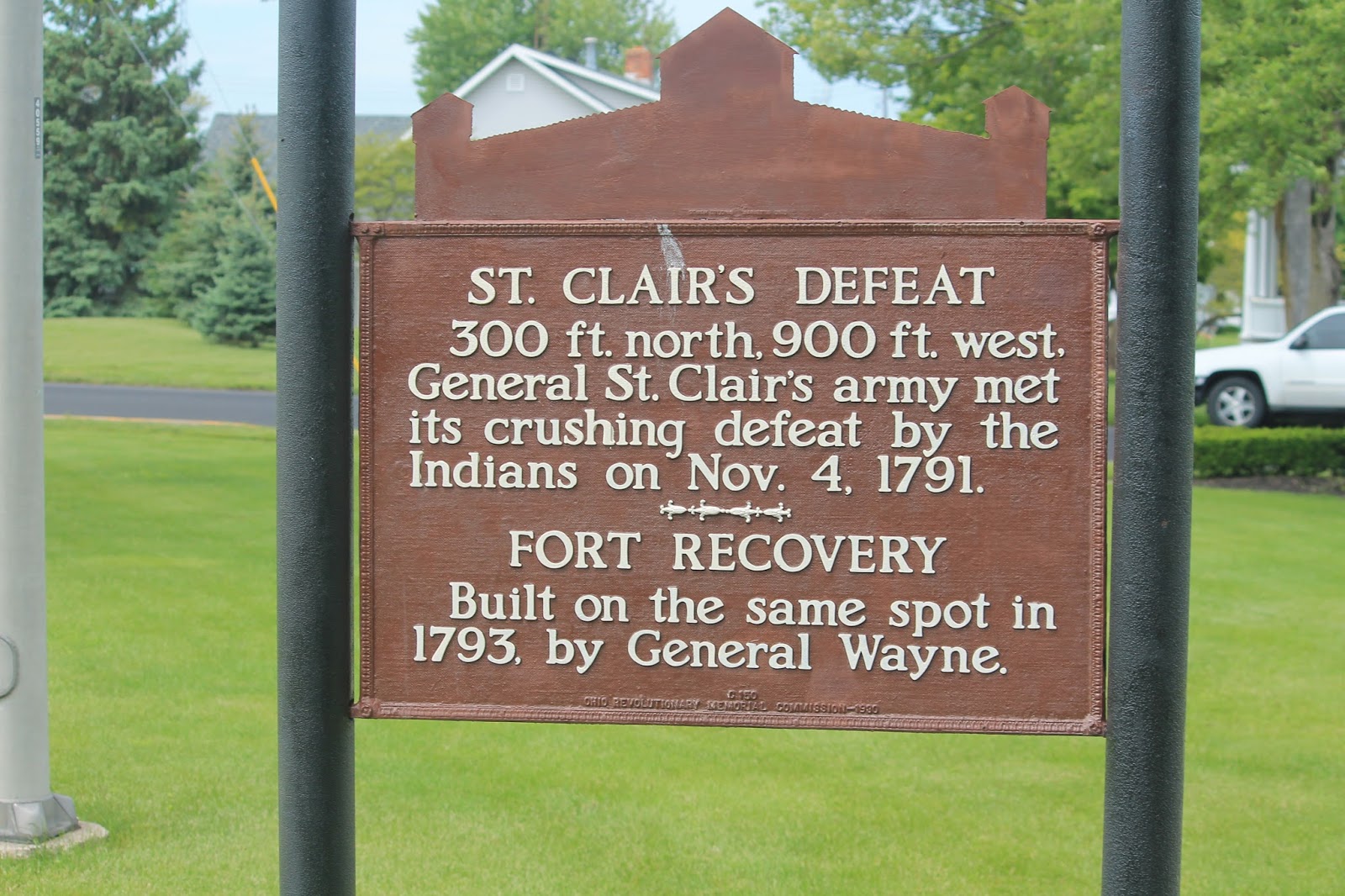
        The settlement of the Northwest Territory played host to some of the most bloody a fiercely contested battles in early American history. None more fiercely contested than those fought against the Native American inhabitants of what is now the states of Ohio and Indiana. For nearly a century members of the Wyandot tribe actively opposed American expansion. Members of their tribe fought with the British during the revolution, the Northwest Indian Wars and the War of 1812 but as was the case for many tribes the effort to stop encroaching settlers was futile.

        Shortly after the battles for the Northwest Territory started Native Americans began to join forces in an effort to try and stop the encroachment of the white man into the Ohio Valley. This loose alliance of tribes was known as the Western Confederacy of Indian Tribes and Bill’s Wyandot tribe was one of the founding members.The Wyandot Indians were known as fierce warriors who were experts with a bow and arrow.It has been said that they were just as accurate shooting an arrow from a charging horse as they were standing on level ground and in the early stages of the war the Wyandot’s were useful allies within the Confederacy. It was not until the Confederacy's devastating defeat at the Battle of Fallen Timbers that tribes like the Wyandot started questioning their ability to defeat the invading American army.

        After the Battle of Falling Timbers the Wyandot tribe split into two different factions with two opposing ideologies about how to survive the ever expanding American settler. One faction lead by Chief Leather lips saw assimilation and peace as a means to survive, while the other faction chose to follow Chief Roundhead and join Tecumseh in continuing the resistance. History tells us that neither strategy worked for very long.

        Bill Moose’s family followed the advice of Chief Leather lips and chose compromise and peace rather than to continue to fight a seemingly invisible foe. However, the peace and compromise eventually gave way to the needs of the American nation. As treaties and boundaries became more and more restrictive to the needs of American expansion, Native American tribes found themselves forced to renegotiate terms. By the time the 1830 Indian Removal Act had been signed into law the tide had already turned on most of the native inhabitants of the Northwest Territory and by 1843 every tribe living within the territory was forced to give up their land and travel west towards the government established Indian reservations.

The Ohio Wyandot tribe was assigned to the Oklahoma Indian Reservation. For most tribal families this is where the history of their homeland ends and their history on the reservation begins but to my surprise Bill’s family history was different.  Bill’s family was one of twelve families that refused to leave Ohio and took up residency near present day Dublin, Ohio.

What Is Known About Bill Moose ?  
                              
Born on Sept. 9 1837, assimilation and the presence of a European culture was all that Bill Moose had known. By the time of his birth Chief Tecumseh and Roundhead had already failed in their bid to regain the territory given up by his forefathers and Bill’s family was more a novelty to days gone by, than a threat to western expansion.
It is believed that Bill first learned to read and write from the traveling missionaries who would occasionally drop by his family’s settlement. At the age of sixteen Bill was sent to live with a Christian family in Pennsylvania. It was there that he was taught carpentry, plumbing, and wood carving. Bill never stayed away from his Ohio homeland for too long and within a few years Bill returned to Ohio utilizing the skills he had learned in Pennsylvania. Once back in Ohio, Bill found odd jobs working as a handyman for local famers and shop keepers but even though he was said to have been a skilled craftsman who could read and write he showed little desire to fully assimilate into the western culture.  Bill instead chose to live in a small hand built cabin near the Scioto River.  He often worked for free and he either hunted, planted or fished for his food. Bill was known to trade wild game he had killed for blankets and clothing but otherwise he seemed to be content to live a meager lifestyle. 


In 1878 Bill was hired by the Sells Brothers Circus as an Indian rider in their Wild West show.To Bill the idea of riding around on horses all day was an easy way to make a living and something that came naturally to him.[4] It was at this time that Bill received his stereotypical headdress and Indian garb. Bill was told that the outfit was how the audience expected an Indian to look. Not one to fuss over trivial things, even those that were ignorant of his culture; Bill dawned the outfit and played the part for the cheering crowds. Always the showman Bill even dressed in full ceremonial clothing complete with headdress for local tourists and passer-bys who stopped by for a picture with the real life Wyandot Indian.[5]

         For 9 years and in nearly every state in the country, the man known as “Indian Bill” amazed audiences with his acts of equestrian marksmanship. After returning from the circus Bill became somewhat of  local attraction and the non-official ambassador for his people. The shining example of old world customs mixed with new world experiences.


        At the age of 78 Bill found himself once again standing on the banks of the Scioto River but as an old man who had outlived his family, his tribe and his bloodline. After seeing the places that Bill saw and living the life of an entertainer, one could understand if Bill returned home a changed man but that was not the case. Upon his return to Ohio Bill moved back to his one room shack that had become a playhouse of sorts for the local children and began to live his life in the same manner he did prior to his stint in the Circus. The only real change in his life style was the town folk and tourists who would occasionally stop by to get a glimpse of him. Bill was said to have been soft spoken, respectful, and always willing to discuss his native heritage with anyone who stopped by for a visit. Bill would spend his free time making trinkets to share with his visitors or taking pictures with passer-bys. In his life Bill had seen his tribe dwindle and move away. Those who did not move, he saw buried in a hilltop cemetery alongside his own mother and father.I found no one who had anything harsh to say about Bill. He truly seemed to be a man who became a respected part of a foreign community while remaining true to his own heritage.

        Bill Moose Crowfoot died two months short of a century at his home on the banks of the Scioto River.He was a good man, a friend to many and the last full blooded Wyandot Indian to live in the Northwest Territory.

        Bill is buried near his mother and father on what is now called “Wyandot Hill” outside of present day Columbus Ohio.


        In his long life Bill had made many friends and few enemies. His funeral was reportedly attended by no less than twenty thousand people. A monument known as the “Granite Tepee” was erected on the banks of the Scioto River in his honor. Those who knew Bill well remember him as a simple man who would often be found walking along the Scioto, blanket and gun in hand. Bill once said that he preferred the serenity of sleeping outdoors to the four walls of a bedroom. This post is written out of respect for a man who faced immense personal hardship in a time of incredible change, all the while finding peace and balance while living in a culture foreign to his own.


[1] Ohio History Central. Wyandot Indians. http://www.ohiohistorycentral.org/w/Wyandot_Indians.
[2] Wilhelm, Carol. "‘Indian Bill’ fascinated many." This Week News. Mar. 28, 2014. http://www.thisweeknews.com/content/stories/olentangy/news/2014/03/25/history-today-indian-bill-fascinated-many.html.
[3] Bill Moose, c. 1920. Nov 19, 2013, Retrieved from the Upper Arlington Archives. http://www.uaarchives.org/cdm/ref/collection/p4036coll10/id/343.
[4] Tebben, Gerald. "City mourns Bill Moose, the last of the Wyandots." The Columbus Dispatch, July 12, 2012
[5] Thompson, Jim, and Roger Perry. "document-8280_OBJ.tif." Worthington Memory. 2012. http://www.worthingtonmemory.org/sites/default/files/documents/document-122209.pdf.

Sunday, March 25, 2018

Fort Recovery and the Battle of the Wabash


Fort Recovery, Ohio is a small town located near the head waters of the Wabash River. The center of town boasts a towering obelisk as well as a partial reconstructed fort. The town itself has only a few stop lights and a population of less than 1500 but it is a place of much historical significance. Unfortunately most people have never heard of the town or its history.

If you ask people to name the worst defeats ever handed down to an American fighting force, you will most likely hear them mention Custer’s last stand at the Battle of Little Bighorn or the 1812 invasion of Canada. You may even hear them suggest that the Texan defeat at the Alamo is the worst. What you are probably not going to hear mentioned is St Clair’s defeat at the Battle of the Wabash....but.... Why would you? Most history books and nearly all history classes skip right over this significant battle in United States history.
The Battle of the Wabash took place on a triangle stretch of land near the head waters of the Wabash River in present day Fort Recovery, Ohio. The battle was the largest confrontation between Native Americans and the United States Army and it was also the largest defeat ever suffered by the United States Army. 900 of the roughly 1200 American soldiers met their fate at this battle. In total 25% of the entire American Army was decimated at the hands of the nearly 1500 native warriors. [1]
Why did the war happen?
After the American Revolutionary War the newly formed American nation was deeply in dept and needed to raise money to survive. Under the authority of the Treaty of Paris the government planned to raise money by selling the newly acquired land within the Northwest Territory. That idea sounds non hostile enough but there was a major problem with that idea. The Northwest Territory was Indian country and the Native American inhabitants who lived there were not part of the Treaty of Paris and they had no desire to give their land to the American invaders. As a result of settler expansion, tribes living northwest of the Ohio River decided to band together in defense of their land and form what was called the Western Indian Confederation. [2]
The Confederation was led by Chief Little Turtle of the Miamis, Chief Blue Jacket of the Shawnees and Chief Buckongahelas of the Delaware Indians. Blackhoof, Tecumseh and his brother the Prophet were all members of the Confederation and all were reported to have fought during the Battle of the Wabash.
    
Cheif Little Turtle
Cheif Blue Jacket

General St. Clair
  

 Under the orders of President George Washington General Arthur St. Clair had undertook a campaign to rid the greater Ohio valley of all its native inhabitants. Roughly 1200 soldiers and 250 civilians had set up camp near the head waters of the Wabash River. On November 4th 1791 the first attack took place. Led by Chief Little Turtle the first attack came so swiftly that several of the American fighters fled in panic without even so much as grabbing their guns. By the time the others readied themselves for battle Little Turtle’s forces had already surrounding them. St Clair, with his cannons positioned in a clearing on the high ground; ordered them to fire at the attacking natives. However, unbeknown to him, Chief Blue Jacket had positioned his Shawnee marksmen to take them out as soon as they were wheeled into position. Tecumseh and his band of Indian scouts had been tracking and watching the movement of St. Clair’s men for days. The Native attackers were very well prepared and they knew the lay of the land.
The battle raged for three long hours. In total 920 American soldiers and nearly 100 civilians were killed compared to the meager 21 Confederation warriors lost. Severely wounded and in a final charge General St Clair managed to escape with an estimated 200 soldiers and civilians but the battle was a near total annihilation and a massive blow for the United States military.

St Clair Monument
St. Clair statue


                                                                                             The Aftermath

           In the wake of the crushing defeat General St Clair resigned his commission and returned to the less dangerous role of Governor of the Ohio Territory. As a result of the Battle of the Wabash, congress passed two militia acts; one required that all able bodied men sign up for active duty in their state militias and the second granted the President the power to call upon those militias to fight on behalf of the United States.[3]
Under his new found authority President Washington ordered that the army be enlarged and within the year he had nearly doubled the previous size of the units under the command of General “Mad Dog” Anthony Wayne. In 1793 General Wayne sent 8 infantry units along with artillery to the very sight of St. Clair’s defeat. Wayne ordered the construction and fortification of Fort Recovery.
Fort Recovery
In the coming months native skirmishes and raids were attempted but the Confederation was now out manned and out gunned. The surrounding tribes would never again find victory at the site and were forced to withdraw and flee the area.[4]
Greenville Treaty Line Marker
 In 1794 Wayne put an end to the Western Confederacy when his much larger and well trained army won a decisive victory over the Confederacy on the banks of the Maumee River during the Battle of Fallen Timbers. One year later the Treaty of Greenville was signed and the once power Western Indian Confederacy was forced to relinquish all claims to land south and east of the Greenville treaty line. Native inhabitants living within Ohio and Indiana found themselves unwelcome on their own homeland and in grave danger if they stayed.[5]
The irony of The Battle of the Wabash is that it stands as Americas worst defeat at the hands of the Native Americans but because of that defeat the battle also stands as the call to arms that would lead to a national military and near genocidal results for the Native inhabitants of the Northwest Territory.


[1] Winkler, John F. Wabash 1791: St Clair’s defeat. Bloomsbury Publishing, 2011
[2] See Winkler and Eid, Leroy V. "American Indian military leadership: St. Clair's 1791 defeat." The Journal of Military History 57, no. 1 (1993): 71.
[3] "1792 Militia Act establishes conscription under federal law." 2009. https://www.history.com/this-day-in-history/militia-act-establishes-conscription-under-federal-law.
[4] Hurt, R. Douglas. The Ohio Frontier: Crucible of the Old Northwest, 1720-1830. Bloomington, IN: Indiana University Press, 1996 
[5] Pratt, G. Michael. "The Battle of Fallen Timbers: An Eyewitness Perspective." Northwest Ohio Quarterly 67 (1995): 4-34. and Sugden, John. Blue Jacket: Warrior of the Shawnees. Lincoln: University of Nebraska Press, 2000.


Saturday, November 11, 2017

The Newark Earthworks

The Road, The Stone and The Heavens

Nestled by Ohio’s Capital city is another “wonder of the ancient world”.[1] The 2000 year old Newark Earthworks is a collection of mounds formed to make geometric shapes that are the largest of their kind found anywhere in the world. The site consists of a circle, an octagon and a square, all of which are connected by roads. The site has been called the” Crown Jewel of the Hopewell Culture” and one of the most traveled to destinations of the ancient world.[2] The site is so large in scale that it can only be seen in its entirety from the air and each geometric shape is so massive that they become nearly inconceivable and almost impossible to photograph from the ground. To be honest this is one of those ancient ruins that must be seen to be fully appreciated.


For those who take the time to stop by Newark Earthworks Museum and State Park you will be greeted by a long manicured grass hill that is visible from the main parking lot.


(View from the parking lot) 

          However once you have made your way up the path towards the museum you will find yourself standing at the entrance to the Great Circle.The nearly 14 ft. gateway that leads to the interior of the circle is made completely out of dirt and wood and gives the appearance that you are peering into something special. Once inside the Great Circle the vastness of the interior is revealed. Even though others may be wandering around it gives you the feeling as though you have the run of the place. Even though the circle is situated near the busiest section of town the walls of the Circle seem to drown out the noise of the city and provide a sense of seclusion. It is no wander why this place was once celebrated as a spiritual destination.

(View from the Trench and inner Circle)

The Great Circle is nearly 1,200 feet in diameter with 8 foot high walls set atop of a 5 foot deep trench that is said to have once contained water. The interior of the circle is nearly four football fields long and so spacious that the Great Pyramid of Giza could sit inside its walls and never touch a side.

Most of the Earthworks complex has been destroyed by modern expansion but the Octagon Mound and the Great Circle Mound are still visible today. Unfortunately the Great Circle Mound is the only remaining mound that is still open to the public. A private golf course and country club currently reside inside the Octagon Mound and because of this it is only open to the public a few times a year.

(Artist recreation of the Newark Earthworks)

Unlike most of the mounds found throughout Ohio and Indiana, the Great Circle Mound does not contain burials. Early explores believed that the mound was the ruins of an ancient fort but modern researchers find this explanation unlikely do to the fact that there is no evidence of construction beyond the current geometric designs. The modern consensus is that the purpose of the Earthworks was ceremonial and astrological. Basically the entire earthworks complex is a giant calendar that doubled as a place of celebration.

Archaeoastronomy

The Great Circle Mound and the entire Earthworks complex was laid out in a manner that would allow certain elements to align with different movements of the sun and the moon. Modern researchers have termed this type of architecture “archaeoastronomy”. The Hopewell Indians and their Newark Earthworks were among the first structures to incorporate this type of architecture.

The gateway that leads to the inside of the Great Circle Mound is positioned to align with the summer and winter solstice while the gateway to the Octagon Mound is positioned to align with the seasonal rising and setting of the moon. It is believed that the other geometric shapes that once existed followed this same architectural style. Researchers believe that these alignments served as markers for the changing of the seasons.[3] Considering the tools that would have been used 2000 years ago, the precision of the structures are truly amazing


How these geometric shapes were so precisely designed remains a mystery to modern researchers but that is not the only mystery to be had at the Earthworks complex. Newark Earthworks may also have some of the earliest roads known to exist.

The Hopewell Road

When discussing ancient roadways it is highly unlikely that anyone would mention prehistoric Native Americans however, modern research may provide an argument for the Hopewell’s inclusion into the discussion. The Earthworks found in Newark show evidence that they were once interconnected by roads that extended well beyond their borders. Even though  much of the original landscape has given way to modern advancement, researchers have discovered what appears to be the remnants of an ancient road. The remnants have been dated to the time of the Hopewell Culture. This means that if the road existed during the Hopewell Culture then it is one of the oldest roads in the world.
The Hopewell Indians existed from approximately 500 BC to 1000 AD. The Newark Earthworks was constructed sometime prior to 100 BC. This means that the road would have been built around the same time as the Romans were building their first roads.

That is something I bet your high school history teacher neglected to tell you while discussing the amazing advancements made by the Roman Empire.

Currently the Hopewell Road lies just below a thin layer of sod and grass. Researchers describe the road as a straight line that stretches 60 miles with parallel earthen embankments that are approximately 3 feet in height and 200 feet apart.[5] It is unknown if the road was originally covered with soil or if it simply became overgrown with time.

Things that make you go Hmmm???

The invention of the wheel and the use of horses is believed to have been brought from Europe long after the Hopewell were gone. Because of this it is not unusual to find roads in association with later cultures that use one or both of those things. However, the Hopewell are believed to have had neither of those luxuries so the discovery of a road is a bit compelling. It is well known that the Hopewell Indians were long distance travelers and traders but artifacts suggest that they did so on foot or by boat. So the logical question is…….Why did the Hopewell need roads if their two primary forms of transportation were walking and boating?

Perhaps the road was simply a grand gesture fitting the grandness of the Earthworks complex or maybe the goal of the road was to encourage travel to and from the earthworks. The simple fact is that ancient America is so understudied and misrepresented that places like Newark Earthworks makes people start to question what they thought they knew about America prior to the arrival of the Europeans. It may even be that the Hopewell did have other means of transportation that have yet to be discovered. The only thing that is certain is that the Hopewell Road demonstrates that there is much left to discover and explain about life in prehistoric North America.

The Newark Holy Stones

Located near the center of the Great Circle is three small mounds called the Eagle Mounds.They are said to be called this because they resemble an eagles claw. However, that is not all these little mounds are famous for.
 
(Present day Eagle Mounds)
In 1860 a man named David Wyrick found an inscribed stone while excavating near Eagle Mounds. The stone contained a condensed version of the Ten Commandments written in a style of writing most associated with the tribes of Israel. The stone is one of the most controversial and debated artifacts to ever come out of North America. The stone is even housed in a museum that is not supported or connected to the Earthworks complex and the only thing that can be viewed at the complex is a copy of an old newspaper clipping that describes the finding.

The stone is approximately 6 inches long and is made of limestone. The front of the stone contains an image of Moses while the outer edges and back of the stone contain the Hebrew script. Because of the Hebrew script Wyrick believed that the stone must have come from one of the tribes of Israel and thus began the debate.

(Newark Holy Stone)

The age of the stone has never been determined and a definitive explanation for its origin remains a matter of debate. Some experts say Wyrick faked the stone; others say he was duped into believing that the stone is real, while still others argue for its authenticity. [6] Until more light can be shed on the artifact the true origin of the stone may never be revealed. Like many things about the Newark Earthworks the Decalogue Stone, more commonly known as the Newark Holy Stone remains a mystery.

If you find yourself in the vicinity of Newark Ohio and you have some time to kill, I highly recommend visiting the Newark Earthworks. This ancient example of prehistoric America is well worth the trip and it is something that is best seen rather than described.


[1] Bradley T. Lepper, The Newark Earthworks: A Wonder of the Ancient World' Columbus , (Ohio: Ohio Historical Society, 2002).

[2] Susan L. Woodward, and Jerry N. McDonald, Indian Mounds of the Ohio Valley: A Guide to Adena and Hopewell Sites, The McDonald & Woodward Publishing Company, (Blacksburg, Virginia, 1986)  p.16-23.

[3] Lindsay Jones, and Richard D. Shiels, The Newark Earthworks: Enduring Monuments, Contested Meanings. Charlottesville: University of Virginia Press, 2016, https://muse.jhu.edu/.

[4Photo by Timothy E. Black

[5] Bradley T. Lepper, "Tracking Ohio's great Hopewell Road," Archaeology 48, no. 6 (1995): 52-56

[6] J. Huston McCulloch,. The Newark, Ohio Decalogue Stone and Keystone, Symposium, Nov. 6, 1999, http://www.econ.ohio-state.edu/jhm/arch/decalog.html.